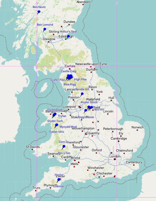
This is a list of major peaks and ridges in the UK that are of particular interest for mountaineering, scrambling or rock climbing. I have marked the ones which I have climbed and I provide photos and GPS measurements of their summits, where they could be acquired.
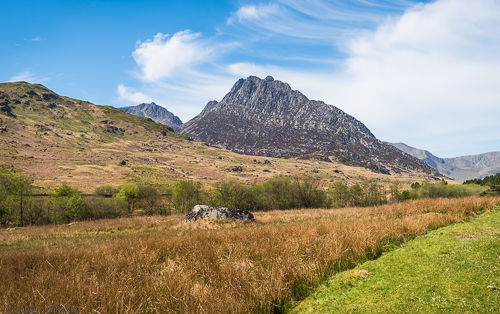
The GPS coordinates listed are given in WGS 84 datum and the altitudes are derived from barometric measurements that were calibrated to previous GPS-determined elevations with high accuracy.
England | Scotland | Wales | Northern Ireland | Changes
England
Scafell Pike (978 m)
Highest in England, in the Lake District. The fastest route from the National Trust car park near Wasdale Head to the summit is about 9.3 km long, but fairly boring even in clear weather.
Own measurement: N54° 27.254 W003° 12.691, 980 m.
Climbed: 2018-07 (via fastest route), 2018-04 (only halfway due to heavy rain)
Scafell (964 m)
In the Lake District.
Helvellyn (950 m)
In the Lake District.
-
Striding Edge
Classic grade 1 scramble. The proper route goes right along the (decently broad) top of the ridge. However, many of the difficulties can be avoided by walking on a footpath a little bit lower on the right and later left side of the ridge line.
-
Swirral Edge
The somewhat easier and shorter sister of Striding Edge, situated a few hundred metres further on Helvellyn.
Own measurement: N54° 31.646 W003° 01.122, 947 m.
Climbed: 2019-09 (up via Striding and down via Swirral Edge)
Great Gable (899 m)
In the Lake District.
-
Needle ridge
Proper grade V climb, rather than a scramble.
Catstycam (890 m)
In the Lake District, near Helvellyn. Also sometimes spelled as Catsty Cam.
Own measurement: N54° 32.009 W003° 00.535, 894 m.
Climbed: 2019-09 (coming from Helvellyn on the way back to Glenridding)
Fairfield (873 m)
In the Lake District. Fairly broad summit plateau. Not very spectacular.
Own measurement: N54° 29.807 W002° 59.507, 875 m.
Climbed: 2019-08 (summer conditions), 2019-03 (in snow and winter conditions)
Blencathra or Saddleback (868 m)
In the northern Lake District.
-
Sharp Edge
The “bad step” and the “usual gully” are two accident black spots known by mountain rescue.
-
Hall’s Fell ridge
St Sunday Crag (841 m)
In the Lake District.
-
Pinnacle ridge
Grade 3 scramble, but many difficulties can be avoided.
Hart Crag (822 m)
Near Fairfield, in the Lake District.
Own measurement: N54° 29.536 W002° 58.536, 826 m.
Climbed: 2019-08
Lingmell (807 m)
In the Lake District.
Ingleborough (723 m)
Second-highest mountain in the Yorkshire Dales. Part of the Yorkshire Three Peaks.
The Gaping Gill cave is located closeby.
Pavey Ark (700 m)
In the Lake District.
-
Jack’s Rake
Awkward grade 1 scramble along and up the side of a rock face, loose and slippery rock.
Pen y Ghent (694 m)
In the Yorkshire Dales. Easy climb. Part of the Yorkshire Three Peaks.
High Pike (658 m)
Near Fairfield, in the Lake District.
Own measurement: N54° 28.257 W002° 58.006, 658 m.
Climbed: 2019-08
Kinder Scout (636 m)
In the Peak District, near Manchester.
Own measurement: N53° 23.082 W001° 52.260, 637 m.
Climbed: 2018-11, 2018-03
Pendle Hill (557 m)
In the east of Lancashire, part of the Forest of Bowland Area of Outstanding Natural Beauty.
It is infamously known for the Pendle witch trials of 1612 and alleged supernatural activity.
Own measurement: N53° 52.116 W002° 17.911, 558 m.
Climbed: 2020-12 (early winter, snow on the ground)
Blea Rigg (541 m)
In Cumbria, Lake District, near Grasmere.
Own measurement: There are two obvious peaks that are close to each other, with the official GPS point being somewhere between them. The official point does not seem to correspond to a dedicated rock feature.
- N54° 27.666 W003° 04.727, 544 m.
- N54° 27.724 W003° 05.037, 557 m.
Climbed: 2018-12
Mam Tor (517 m)
In the Peak District, near Manchester.
Own measurement: N53° 20.956 W001° 48.579, 520 m.
Climbed: 2019-06, 2018-06
The Roaches (505 m)
In the south of the Peak District. Popular local climbing area.
Win Hill (463 m)
In the Peak District, near Manchester.
Own measurement: N53° 21.744 W001° 43.246, 466 m.
Climbed: 2019-08
Haytor (457 m)
In Dartmoor National Park, Devon, southwest England.
There are two prominent rock formations, with the eastern one called Haytor and the western one sometimes named Lowman. Haytor is far more prominent than its companion, and climbing it is significantly more exposed.
Own measurements:
- Haytor: N50° 34.818 W003° 45.319, 458 m.
- Lowman: N50° 34.792 W003° 45.410, 459 m.
Climbed: 2020-09
Cat Bells (451 m)
In Cumbria, Lake District, near Keswick.
Chrome Hill (425 m)
In the Peak District, Derbyshire. Near Earl Sterndale.
Access via a decent ridge walk with a significant ascent and incline.
Own measurements:
- N53° 12.190 W001° 53.743, 444 m.
- N53° 12.187 W001° 53.741, 445 m.
Climbed: 2021-04 (nice sunshine), 2020-12 (snow on the ground)
Now that I climbed and measured the top of Chrome Hill on multiple occasions, I am reasonably sure that its official elevation is about 20 m too low.
Hen Cloud (410 m)
In the south of the Peak District, part of The Roaches. Popular local climbing area.
It is a reasonably straightforward climb from the road, and once on the ridge it leads to The Roaches summit in the north some distance away.
Own measurement: N53° 09.080 W001° 59.325, 414 m.
Climbed: 2021-04
Tegg’s Nose (380 m)
East of Macclesfield in Cheshire, near Manchester.
Own measurements: N53° 15.024 W002° 04.770, 388 m.
Climbed: 2020-10
Hitter Hill (362 m)
In the Peak District, Derbyshire. Near Earl Sterndale and Chrome Hill.
Flat summit and little prominence.
Parkhouse Hill (360 m)
In the Peak District, Derbyshire. Near Earl Sterndale and close to Chrome Hill.
Characteristic shark tooth appearance. The western slopes include some easy scrambling and exhibit significant erosion.
Own measurement: N53° 11.986 W001° 52.939, 382 m.
Climbed: 2021-04
Same as for Chrome Hill, I highly suspect that the official elevation value is about 20 m too low. However, I do not have multiple GPS measurements yet, so I cannot say for certain.
Castle Crag (290 m)
In the Lake District, accessible as part of the Borger Dalr geology walk.
Own measurement: N54° 31.990 W003° 09.697, 291 m.
Climbed: 2018-04
England | Scotland | Wales | Northern Ireland | Changes
Scotland
Ben Nevis (1345 m)
Highest peak in Scotland and the UK. Near Fort William and Glen Nevis in the northwest Highlands. There is a large plateau on the summit, with a tiny emergency shelter and ruins of a meterological observatory and small hotel.
Own measurement: N56° 47.812 W005° 00.211, 1345 m.
Climbed: 2018-08 (via the Mountain Track, time taken: 2:30 h up, 1:45 down)
-
Carn Mor Dearg (CMD) arete
A popular variation of the climb up Ben Nevis that leads around the north face of the mountain up to Carn Mor Dearg peak. From there it is a reasonably easy scramble south along the CMD arete up to Ben Nevis summit. The climb can be done from Glen Nevis (about 19 km), or the north face car park near Torlundy (about 21 km and initially steeper).
Ben Macdui (1309 m)
Second highest mountain in the UK. Close to Aviemore and Glenmore in the Cairngorms national park.
Schiehallion (1083 m)
In Perth and Kinross.
Buachaille Etive Mor (1021 m)
Sports four main tops.
Sgurr Alasdair (992 m)
Near Glenbrittle on the Isle of Skye. Highest peak of the Black Cuillin ridge and the Isle of Sky.
-
Black Cuillin ridge
Grade 3 scramble. Most certainly the hardest ridge walk in the UK.
Ben Lomond (974 m)
In Loch Lomond & The Trossachs National Park.
Own measurement: N56° 11.419 W004° 37.985, 972 m.
Climbed: 2018-08 (time taken: 4 h in total)
Arthur’s Seat (251 m)
Highest point in Edinburgh.
Own measurement: N55° 56.644 W003° 09.710, 254 m.
Climbed: 2018-08
Aonach Eagach ridge
Near Glencoe in the west Highlands. Grade 2 scramble, narrow ridge, exposed. Solo un-roped climb with sections where a rope would give confidence to some climbers. No escape routes once on the ridge. Slippery during/after rain.
The “crazy pinnacles” form the narrowest section of the ridge and the most exposed. The ridge contains two Munro summits, Sgor nam Fiannaidh and Meall Dearg.
An Teallach ridge
In the north Highlands. Grade 3 scramble, but many difficulties can be avoided.
England | Scotland | Wales | Northern Ireland | Changes
Wales
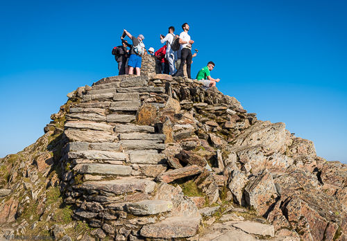
Snowdon (1085 m)
Highest in Wales, in Snowdonia, part of the Welsh 3000s.
Own measurement: N53° 04.109 W004° 04.575, 1084 m.
Climbed: 2018-11 (via Rhyd Ddu Path), 2018-05 (via Pyg and Miner’s track)
Garnedd Ugain (1065 m)
In Snowdonia, part of the Welsh 3000s.
- Crib y Ddysgl ridge
Glyder Fawr (1001 m)
In Snowdonia, part of the Welsh 3000s. The summit is a rock structure on top of a wide plateau.
Own measurement: N53° 06.088 W004° 01.750, 999 m.
Climbed: 2018-10, 2018-05
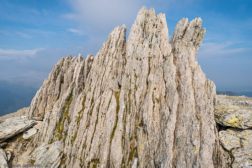
Glyder Fach (994 m)
In Snowdonia, part of the Welsh 3000s. The final climb to the very summit requires basic climbing skills.
-
Main peak
Own measurement: N53° 06.289 W004° 00.502, 993 m.
Climbed: 2018-10, 2018-05
-
Bristly Ridge
Classic grade 1 scramble.
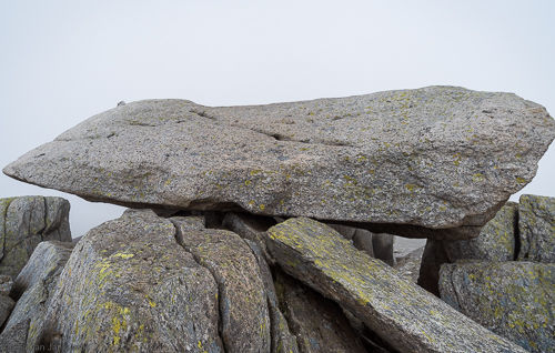
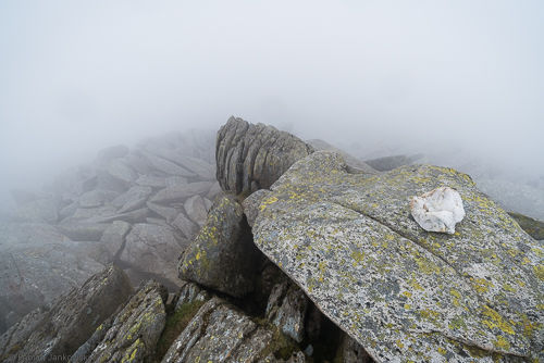
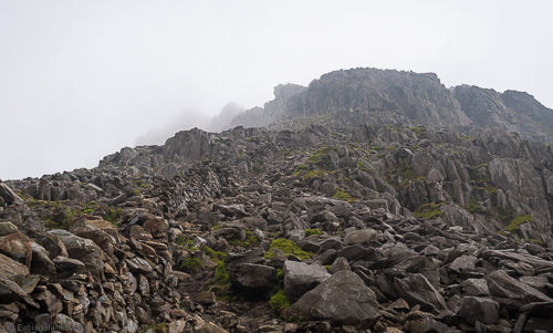
Castell-Y-Gwynt (972 m)
In Snowdonia, Castle of the Wind. Requires basic climbing technique to reach the summit.
Own measurement: N53° 06.227 W004° 00.719, 971 m. This is about 1 m from the true summit, which is quite exposed.
Climbed: 2018-05
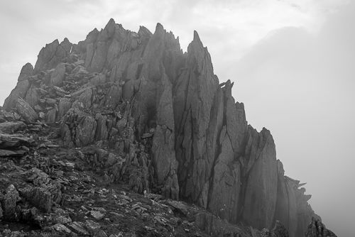
Y Garn (947 m)
In Snowdonia, part of the Welsh 3000s.
Climbed: 2018-10
Crib Goch (923 m)
In Snowdonia, part of the Welsh 3000s.
-
Crib Goch ridge
Classic grade 1 scramble, knife edge, high exposure.
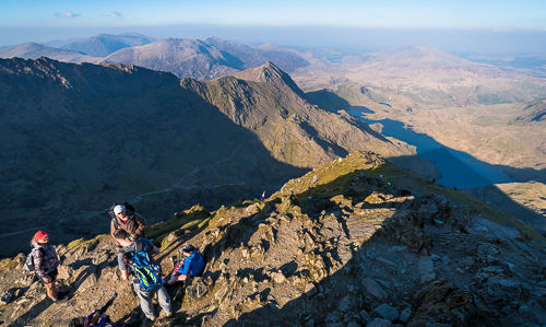
Llech Ddu Spur
In Snowdonia.
Tryfan (918 m)
In Snowdonia, Ogwen valley, part of the Welsh 3000s.
-
Main peak
Own measurement: N53° 06.893 W003° 59.852, 919 m.
Climbed: 2019-05 (via north ridge), 2018-05 (via south ridge)
-
Tryfan south peak
Own measurement: N53° 06.863 W003° 59.859, 914 m.
Climbed: 2019-05 (via north ridge), 2018-05 (via south ridge)
-
North ridge
Classic grade 1 scramble.

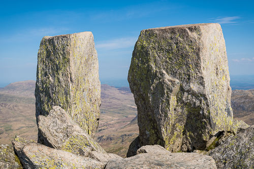
Y Lliwedd (898 m)
In Snowdonia.
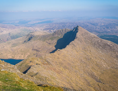
Cadair Idris (893 m)
In south Snowdonia.
Own measurement: N52° 41.977 W003° 54.529, 899 m.
Climbed: 2018-05
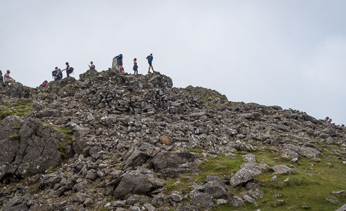
Pen y Fan (886 m)
In south Wales, Brecon Beacons National Park.
Own measurement: N51° 53.045 W003° 26.209, 890 m.
Climbed: 2020-08
Corn Du (873 m)
In South Wales, Brecon Beacons National Park, near Pen y Fan.
Own measurement: N51° 52.901 W003° 26.627, 878 m.
Climbed: 2020-08
Mynydd Moel (863 m)
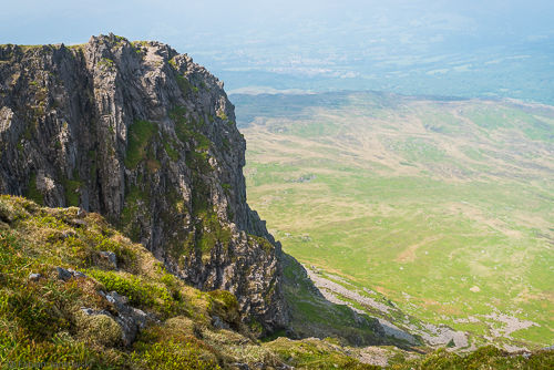
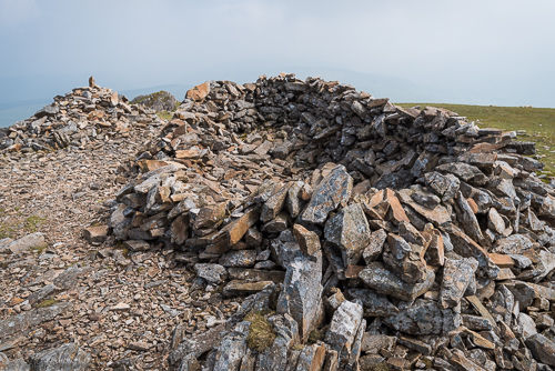
In south Snowdonia, second highest peak near Cadair Idris.
Own measurement: N52° 42.344 W003° 53.084, 870 m.
Climbed: 2019-05, 2018-05
Gau Graig (684 m)
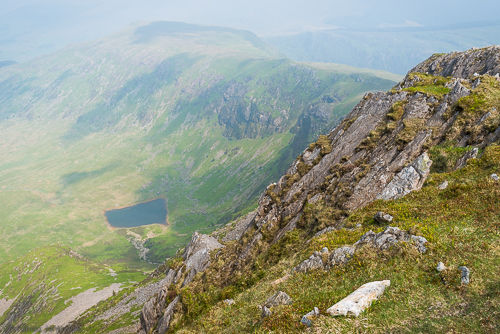
In south Snowdonia.
England | Scotland | Wales | Northern Ireland | Changes
Northern Ireland
Slieve Donard (850 m)
Highest in Northern Ireland.
Slieve Commedagh (767 m)
England | Scotland | Wales | Northern Ireland | Changes
Changes
- 2021-05-02: Added The Roaches and Hen Cloud.
- 2021-05-01: Added Parkhouse and Chrome Hill measurements.
- 2021-01-03: Added Chrome, Parkhouse and Hitter Hill.
- 2020-12-23: Added Pendle Hill measurement, Ingleborough, Tegg’s Nose, Haytor Rocks. Cleaned up the list and improved wording.
- 2020-12-20: Added Pendle Hill.
- 2020-11-29: Added overview map of UK peaks.
- 2020-09-04: Added Pen-y-Fan and Corn Du measurements.
- 2019-09-11: Added Helvellyn and Catstycam.
- 2019-09-02: Added Win Hill, Hart Crag and High Pike, and updated measurement for Fairfield.
- 2019-07-04: Added Mam Tor and Tryfan north ridge scramble.
- 2019-03-18: Added Fairfield.
- 2019-01-14: Improved page navigation.
- 2018-12-10: Added Blea Rigg.
- 2018-11-21: Added Kinder Scout and Snowdon.
- 2018-10-14: Added own measurements for Welsh peaks and added Y Garn.
- 2018-08-10: Added peaks climbed in Scotland. Added additional peaks and elevations from the literature.
- 2018-07-25: Added measurements for Skafell Pike, Kinder Scout and Mam Tor. Improved text.
- 2018-07-20: Added various summit photos. Added peaks in the Peak District.
- 2018-07-17: Added measurement for Skafell Pike and sorted peaks in descending order of elevation.
- 2018-05-29: Added measurements for peaks climbed in Wales.
- 2018-05-22: Added famous ridge climbs. Made ridge climbs subsections of their parent peaks. Added more info. Added dates of climbs instead of number.
- 2018-05-21: Created this document.