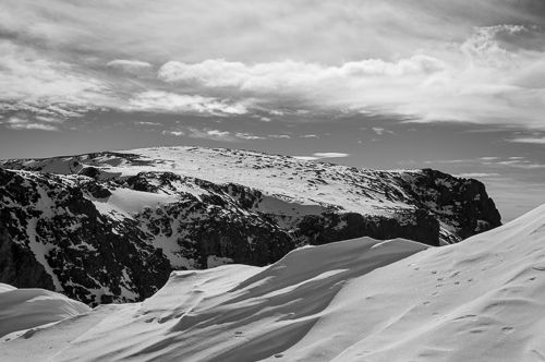
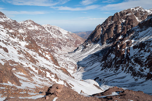
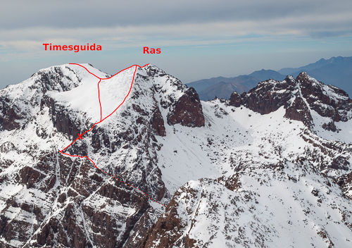
This is a report of my winter mountaineering trip to Ras and Timesguida n’Ouanoukrim. They are the second and third highest peaks in Morocco, North Africa. An approaching storm made me turn around on the summit ridge.

Trip Overview
- Name: Ras and Timesguida n’Ouanoukrim
- Height: 4083 m and 4088 m
- Location: High Atlas, Morocco, Africa
- Date: End of November 2012
- Conditions: Winter
- Route: East ridge from Tizi n’Ouagane
Ras and Timesguida belong to the Ouanoukrim mountain chain and are the second and third highest peaks in Morocco, after Jebel Toubkal. I tried to climb them the day after I summited Toubkal. The approach is the same as for Toubkal, see the section To the refuges there. I stayed in the CAF Toubkal Refuge (3207 m, formerly Refuge Neltner) run by the French alpine club, the smaller and older one of the two refuges below Toubkal.
Climbing Ras
When I woke up, I heard a strange sound that was similar to a siren and nearly as loud. I got ready and stepped out of the refuge’s front door. It was still dark, and the sky was very clear; a lot of stars were visible. It turned out that sound was the wind blowing around the refuge’s walls. It was incredibly strong and freezing. After a quick breakfast, I talked to the guardian and a few of the mountain guides about whether the climb would be safe in these conditions and if there was a more sheltered route. The weather forecast predicted a change in weather on the following night. At this point, I was considering not to attempt the climb and to stay in the refuge instead.
I decided to wait for the sun to rise enough so that I could see the route more easily, as I would be completely alone on it during the climb. The guides with their clients were going up to Toubkal again, but nobody else was attempting Ras that day. I was also hoping that the wind speed would decrease a bit over time.
At around 7:00 and shortly before sunrise I decided to give it a try and to see how high I could make it, fully aware that I might have to turn back if the wind became too strong. It was freezing. I was wearing all the layers of clothing that I had (except for a very thick fleece jacket that I brought mostly for emergency purposes), two pairs of gloves (inner and outer ones), balaclava and the hat of my jacket above it that was closed nearly completely.
From the refuge, the route leads straight up the broad valley, in the same direction as the trail from Imlil to the refuges, up to the col Tizi n’Ouagane. The first part of the route was relatively flat. The trail was marked with cairns, and I could even follow the frozen footsteps of previous climbers in sections where they were not covered with fresh snow.
At around 7:45 I reached a flat section in the shape of a large bowl that I crossed mostly up to its upper end. The footsteps were leading in different directions there. Looking straight up the valley the route was blocked with large boulders, looking to the left there was another trail leading out of the valley to a different mountain. The route to Ras led up to the right, but I had a bit of a problem finding it. After a couple of minutes, I saw something that looked like a path. It was leading me up the right flank of the valley, a rather steep section that is roughly 30 or 40 meters in height. The problem was that the slope was partially covered with ice and that I had to climb over some rocks to avoid it.
At the top, I reached a mountain pass, where finding the route was quite easy as it was confined by cliff bands, mostly on its left side, and zig-zagged up the slope. The downside is that you have to make sure that you do not slip, or you might fall from one of these cliff bands. I was clinging to my ice axe in this part of the climb. I chose a path that had as much distance to the cliff bands as possible. This worked well for most of them, but there was one particularly scary right bend that I could not navigate around. On the right, uphill side there was a vertical rock face, in the middle, there was the path marked with frozen footsteps and to the left, only around 5 m down the slope, started a cliff band. To make it worse, the slope was one of the steepest so far. I pushed the ice axe firmly into the snow down to its head to have a stable anchor in case I should slip, then moved my left foot, pushed the crampons firmly in and made sure they were gripping, then the right one. Then I repositioned the ice axe a bit further left and started the cycle again. I even had my knees leaning against the slope for additional stability. I spent quite some time in this section and was not happy that I had to cross it again on the way down.
After resting a couple of minutes on a nearby rock, I continued the climb. The rest of the route up to the saddle had nearly the same steepness as this scary bend and was much steeper than the section before. Further up I encountered again a part that was covered with ice. It was a quite large area that was covered, and I had to break a new trail through more than knee-deep snow to avoid it altogether. Most of this route up till now led along the high right part of the valley and was sheltered from the wind that was blowing through the gap of the saddle. When I passed another right bend, I stepped out of this shelter and arrived at a snow ramp that led directly up to the saddle. The wind hit me again with full force. This ramp was meagre; there was nothing more than icy snow and a couple of small boulders. The wind had wiped away all the footsteps of previous climbers.
At around 10:00 I arrived at the saddle Tizi n’Ouagane (3750 m). The view towards Igger n’Abdeli (3815 m) with its flat summit was just beautiful. I only spent a few minutes there to take some pictures and to relax a bit. It seemed that the wind speed had not decreased at all in the last three hours. From there the plan was to ascend via the East ridge to the summit of Ras, then cross over to the only a few meters higher summit of Timesguida, descent roughly the same path and return to the refuge.
The East ridge rises directly from Tizi n’Ouagane. First I had to pass through a narrow gap between two rocks to reach a small platform that was entirely covered with snow. On the left side, there was a sharp drop of at least a couple of hundred meters, so I was cautious when crossing it. I reached a vast, nearly flat plateau that I crossed diagonally. The path was well marked with cairns there. They led me to a vertical rock step, maybe around 6 m high. This was the start of the climbing section. I was somewhat sceptical at first; the route was quite exposed, there was a lot of air under me and no belay at all. A fall there would have meant to fall from the ridge - not good at all. So I was climbing very slowly and made sure to find stable footholds. The climbing in itself was straightforward. It was only the mental part that was a bit problematic.

There was another one or two of these steps, but each was lower than the first one. At around 10:30 I reached a small, flat section on the ridge. The wind was really strong at that time, and I was very exposed on the ridge. I found a place that was a bit sheltered from the wind, sat down and took a few pictures. The GPS coordinates were N31°02.515’ W007°56.303’ and the altitude was 3795 m. From there I could see the narrow passage that led up to the higher part of the ridge and then directly to the summit. The wind was too strong for my taste and higher up the ridge there would be even less shelter than where I was. I had also lost a bit too much time in the ice sections, I would probably need at least one hour more to reach Ras and I wanted to descend to Imlil that same day. So I decided it would be best to turn around.

I was not very happy about it; not so much about not summiting Ras, but mostly about the fact that I had to climb the steps down again and make it past the scary bend further down. I spent a few more minutes there to enjoy the view and to eat and relax a bit, but in total, I did not spend more than 20 min there.
The climb down the rock steps was a bit awkward but was not as problematic as I initially thought. I made it again to Tizi n’Ouagane. I took the very same path for the descent as I had taken up the mountain. Except for the ice sections and the scary bend, it was uneventful and the same as when I climbed up. I reached the refuge at around 12:45. Until that time I had not seen anybody else since I left in the early morning. The guardian of the refuge, an old man of probably around 60 years, greeted me and I told him how far I could make it and that I had turned around. He just patted me on the back and told me: “Good decision.”
Descent to Imlil
Now I had to hurry to descend to Imlil before daylight faded. I packed my stuff, restocked the water bottles and paid the bill. It took me about an hour, and I headed out of the refuge at around 14:00. By that time dark clouds filled the valley that I was climbing in a few hours before and the wind speed had increased even more. The mountains in this direction were completely covered in clouds. The weather was apparently changing. I passed some climbers who came up from Imlil. The look on their faces was far from delighted. I was glad that I was not up there anymore.
The descent was long and dull. Near Sidi Chamarouch I met two of the climbers from the refuge who had been on Toubkal that day. They were also hurrying down as fast as they could to reach their guesthouse before nightfall. A few minutes behind Sidi Chamarouch, on the mule trail halfway to Aremd, I realized that I could not concentrate anymore. I was more and more often tripping over some loose stones on the trail and my legs were pretty exhausted. I took a short break and ate and drank as much as I could in this short time. Finally, I pulled myself together and made the rest of the descent.
The sun set shortly after I passed Aremd, I took out my headlamp and descended the rest part to Imlil in the dark. In Imlil, I returned the crampons and ice axe and finally made it to the guesthouse at around 18:15. I was quite exhausted from the trip.
Summary
This route was technically a bit more challenging than the climb to Jebel Toubkal the previous day, mostly because of the scrambling on the East ridge further up. Even though I had to turn around I enjoyed this climb very much, quite a bit more than that to Toubkal actually. Bringing an ice axe (and crampons of course) is a must here in my opinion. From my experience it seems that most climbers come to the High Atlas only to climb Toubkal, but I would recommend to attempt Ras and Timesguida as well if you have the time and the necessary skills.