This is a report of my winter mountaineering trip to the highest mountain of North Africa, the Jebel Toubkal. It is located in the High Atlas in Morocco. I took the South cwm South col route.
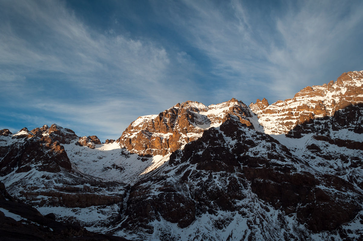
 and Ras (4083 m) near the triangular shaped rock formation in the very right.")
Trip Overview
- Name: Jebel Toubkal
- Height: 4167 m
- Prominence: 3757 m
- Location: High Atlas, Morocco, Africa
- Date: End of November 2012
- Conditions: Winter
- Route: South cwm South col (up and down, see text)
- GPS coordinates (as measured at the summit): N31°03.589’ W007°54.895’
To the Refuges
From Marrakech, I took a shared grand taxi to the small mountain village of Imlil (1740 m), rented crampons and ice axe and spent the night there in a guesthouse a bit outside the village. The next morning I left my big trekking rucksack at the guesthouse, packed all the necessary gear for the climb (including warm sleeping bag!) and headed out towards the refuges. It is possible to hire a mule and muleteer and have your equipment transported to the refuges, but I decided to be the mule myself.
I was not in a hurry, so I started rather late at around 10:00. The trail first leads through the woods and past the Kasbah du Toubkal, a luxurious guest house. After a few hundred meters it leads out of the forest and zig-zags up a small hill. Then I passed the village of Armed, with its stony river bed. Here you have to cross the river to reach the river’s right side (true left). The point of crossing changes with the river’s water level; it is best to ask the locals where to cross it. In my case, I could simply cross the river bed diagonally, as the water level was quite low. On the other bank, there is the entry to a well-travelled mule trail that leads up the mountain straight to the refuges. From here on you just have to follow this trail to its end.
At around 12:45 I reached Sidi Chamarouch (2350 m), a small dwelling with a mosque. I sat down next to a small waterfall, relaxed a bit and had tea with the locals, who worked on extending one of the buildings. I spent roughly half an hour there.
The rest of the hike was rather uneventful, in part even a bit dull. I passed some other climbers, who had their equipment transported by mule and were accompanied both by the muleteer and a mountain guide. All in all, there is quite a lot of mule traffic on this small path. The snowline was somewhere around 2700 m. I took the ice axe out for additional support near the end, when the trail became narrower and narrower and a bit too slippery for my taste.
At around 16:30 I reached the refuges and checked in at the CAF Toubkal Refuge (3207 m, formerly Refuge Neltner), the smaller and older one of the two refuges below Toubkal.


Climbing Toubkal
Carrying the large and warm sleeping bag up the mountain proved to be a good decision, as it was getting freezing cold in the refuge during the night.
Originally, I wanted to do a circular trip. Ascend via the North cwm North col route and then descend via the South cwm South col route. Unfortunately, there had been a blizzard the week before that dumped a lot of snow; and because of that, there was just too much snow on the Northern route, as the guardian and the guides told me. Not very happy about that, I decided to ascend via the Southern route and descend the same way. This is the standard route and is by far the most frequented one. Luckily we were only eight climbers at the refuge who wanted to summit the next day. So the mountain would not be too crowded. In any case, I chose to keep a bit of distance, at least to the guided group.
I started from the refuge around 07:00, shortly before sunrise. From the refuge (3207 m) I went a couple of hundred meters uphill where you have to cross the river. The crossing is a bit steep but unproblematic. From there I headed straight up the hill, where I passed a few frozen waterfalls, which are sometimes used for ice climbing. At the top, you reach the South cwm that leads you in zig-zags directly to Tizi n’Toubkal (3950 m), the South col, or saddle. The climb in the cwm is technically unproblematic, only physically strenuous. I slowly made my way through it uphill and reached Tizi n’Toubkal around 09:45. I spent nearly 15 minutes there, just enjoying the view and relaxing a bit.
The rest of the ascent to the summit is technically a bit more demanding (but still reasonably easy!), as you walk mostly on the summit ridge, the path gets quite narrow and the slopes rather steep right next to you. Bringing an ice axe and knowing how to use it to self-arrest yourself in case you slip, will give you a lot more confidence, especially if you are climbing alone. After completing this traverse on the ridge, I reached the summit plateau. From there you have to turn right, and the metal pyramid (used as a trigonometric marker), that marks the summit is only a couple of meters away.
I made it to the summit at around 10:45. Now I stood on the highest point of North Africa! And I was completely alone, nobody else was there, except for a small bird. The weather was good, no perceivable wind; I was astonished how quiet and peaceful it was up there. As I was good in time, I decided to have an improvised lunch there, relax a bit and enjoy the beautiful view some more. For the record, the GPS reading at the summit was N31°03.589’ W007°54.895’ and the altitude was measured as 4187 m. That is 20 m higher than the official height of Toubkal, but not too bad for a GPS measurement (the vertical error is usually much higher than the horizontal error there). In total, I spent nearly 45 min on the summit.
For the descent, I took the same route as for the ascent. While I was on the summit ridge, I saw a rather dark cloud appear in the distance. That made me a bit worried, and I tried to descent a bit quicker than usual. With only one stop near the end, I reached the refuge at around 13:30, after 2 hr of descent.
Summary
In summary, this route is technically rather easy, but physically quite demanding. The most fun part with the nicest views starts from Tizi n’Toubkal, the views inside the South cwm, unfortunately, are not that great. If the conditions allow, I would instead recommend to ascend via the North col and descend via the South. In winter time crampons are a must, and I would recommend to bring an ice axe and to know how to use it properly.