This is the second part of a trip report of the ascent to Mulhacén, the highest mountain of continental Spain. We started at the Poquiera mountain hut and took the Western route up to the summit. You might want to read the first part before.

After a good sleep in the Refugio Poquiera, below three layers of blankets and nearly fully clothed, I got ready, had breakfast and took a few pictures of the first sunrays illuminating the mountains. My climbing partner Pia and I had agreed to start the summit push towards Mulhacén at around 08:00, but as it was still quite dark and cold outside, we delayed the start to around 09:00.
As the wind had been powerful in the previous days, we decided to take the Western route through Río Mulhacén and the Mulhacén valley, because we would be sheltered from the wind at least during the first part of the ascent.
In general, there are three different standard routes to the summit of Mulhacén. In order of difficulty: the Southern route over Loma de Mulhacén, all the time along the ridge, is the easiest route, but is also quite exposed to the wind. This is the one that the tourist groups usually take. The Western route follows along Río Mulhacén through the Mulhacén valley and then straight up to the summit. It is of medium difficulty between the other two. Finally, there is the possibility to ascend via the North face of the mountain, but this route is challenging, especially in winter conditions, and requires proper climbing gear and skills. There is another possibility to ascend via the Siete Lagunas and the East face of the mountain, but this seems not to be a conventional route.
As already mentioned, we took the Western route and headed out to the right of the Poquiera hut. After a few hundred meters we reached the Mulhacén river and put the crampons on. The river was completely covered with snow, which had been frozen over during the night. It was solid ice. With crampons on it was quite easy to ascend even the steepest passages in the icy snow, which would have been tricky otherwise.
We tried to walk along the river but stayed away far enough in order not to fall into it, if the snow gave in. Early in the day that would not be much of a problem, as the snow was still very hard, but during the day as the sun melts the surface layer, that could become more and more of a problem.
After around two hours, as we reached higher and higher, we came partially out of the valley, which had shielded us from the high wind during much of the first part. We took shelter behind a large boulder, put our jackets on and had a short rest.
While ascending further, we walked along a couple of smaller Lagunas, small natural ponds filled with water from the mountains, which were frozen at this time of the year and covered with snow. It was not easy to spot them. We walked up until we could see the largest one of them in the distance, the Laguna de la Caldera, but we could not see the Refugio-Vivac de la Caldera, which is supposed to be a natural bivouac shelter close to it.
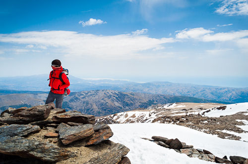
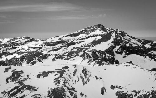
From there we went up to the West ridge that leads up to the summit. This was the time that we stepped truly out of the valley and the first time that we were completely exposed to the wind. It was powerful and freezing. It turned out to be a good decision that we took the Western, more sheltered, route. From the ridge, at around 3000 meters we could directly see most of the steep North face of Mulhacén with its sharp rock formations. On the Northern side of the ridge, there was an impressive drop of a couple of hundred meters into the valley below. The wind was pushing us directly into this direction, so we were cautious not get too close. Nonetheless, we would be walking along this ridge all the way up to the summit in a couple of minutes. From this point, we had a good view of Veleta (3396 m), the second highest mountain of the Sierra Nevada. We cowered behind some small rocks close to the ridge that could barely provide some shelter from the wind, put on the rest of the gear and had a short rest. The steepest and hardest part of the ascent was still upon us.

We ascended the icy slope and were really happy to have crampons, as they provided secure foothold, where a slip would have been very dangerous. It would have meant to slide down most of this steep part back into the valley. We progressed rather slowly. After every couple of steps up the slope, we had to take a few seconds of rest. Pushing the crampons firmly into the ice every time takes away some additional power.
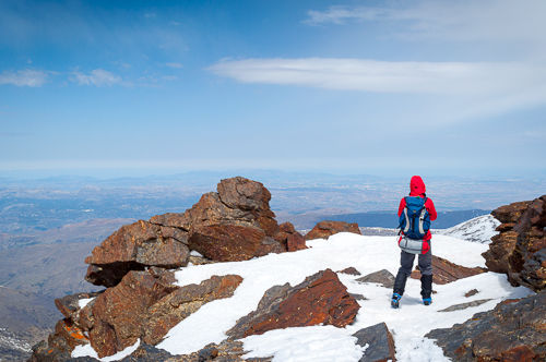
At around halfway up this last part to the summit, the layer of snow and ice was partially broken, and large pieces of rock were exposed entirely. So we took off the crampons and scrambled up further until just a couple of hundred meters below the summit. For the summit section, we put the crampons on again, as it was completely frozen. We followed the last meters along the South ridge and finally reached the summit of Mulhacén! Now we stood at the highest point of Spanish mainland, at 3482 meters above sea level! The ascent from Refugio Poquiera to the summit took us approximately 3 hours and 45 minutes.
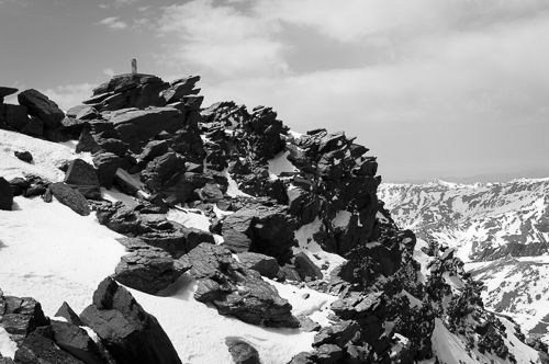
On the summit, there is a geodesic marker in the form of a large concrete cylinder and a small cavern that contains flags and other things that people brought up there. Directly behind it is the North face of the mountain with a very steep drop of a few hundred meters. To the South, on the summit plateau, there are ruins of an old mountain hut. The weather up there was perfect with beautiful sunshine and unobstructed views all around. The only problem was the strong wind. We went a bit to the East, where we could see the summit of Alcazaba (3371 m) and had a great view of both the North face of Mulhacén and Veleta a bit further away. In the distance, we could even see the Mediterranean Sea. It is only around 35 km away from Mulhacén.


After about half an hour on the summit, we decided to descend via the South ridge over Loma de Mulhacén. We feared that the sun had melted the ice above Río Mulhacén too much by now so that it would be likely to sink deep into the snow, or even to fall into the river. And the wind could not be much stronger on the Southern slope than on the summit anyway.
The descent was straightforward on the broad slope and exceptionally well marked. The number of cairns (stone men) was incredible. Halfway down the ridge, we took the direct way down to the Refugio, a path that is marked on the map as a cross-country ski itinerary. That saved us a long detour on the normal hiking path but was quite steep at some points. There was the additional problem that we were above the Refugio, but could not see it at all from up there! It was completely hidden behind a ridge. Only at the very last section of the trail, it became visible, and we were relieved. The descent took us roughly 2 hr and 45 min.
Descent to Trevélez
At the Refugio I had about half an hour to return the crampons, pay, pack all my stuff and relax a bit, as I wanted to descent later that day and did not want to hike in the dark on unknown terrain. So I stepped out of the Refugio at around 17:30 and headed East towards Trevélez. I was nearly running up the mountain, as time was pressing. I followed along the broad (for a mountain road at about 2800 m) support road that leads to the Refugio, as I could progress fast on it. I made it in good time up to Alto del Churrillo and the Mirador de Trevélez, which is a viewpoint high above the village of Trevélez, from where you can overview the whole valley.
The path down towards Trevélez turned out to be very steep and much more dangerous than expected. It was quite narrow at times with a considerable drop on one side. Many small rocks covered the trail. I was happy that I hurried up the mountain in the first part, as I could only walk rather slowly on this trail.
Despite hiking down serpentine after serpentine, Trevélez drew nearer only very slowly. The light of day already started to fade away. After around 3 hours I reached Trevélez. I headed up to the camping site and reached my tent just a couple of minutes before it turned dark. I had a well-deserved dinner, packed my equipment and went to bed, as I had to wake up at 05:00 in the morning the following day to catch the first bus back to Granada.
Summary
In total the trip Capileira, Refugio Poquiera, Pico Mulhacén, Refugio Poquiera, Trevélez was about 30 km distance on the ground and covered a bit over 2000 m of difference in altitude.