In the following, I have assembled a list of all major and some minor peaks in Australia, ordered by state. I give a short description, show a photo or two and list the official elevation. Besides, I provide the coordinates and altitudes that I measured using a GPS device when climbing the mountains.
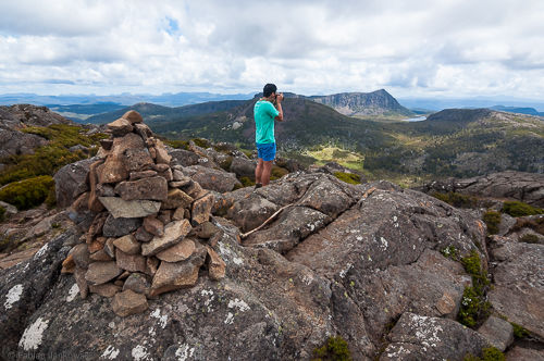
Australia is a relatively flat continent, with its highest peak reaching an elevation of 2228 m above sea level. That said, there are still plenty of opportunities to practise mountaineering and rock climbing, as you will see.
NSW | ACT | TAS | VIC | NT | Changes
New South Wales
Mt. Kosciuszko (2228 m)
Highest in Australia.
Own measurement: S36° 27.350 E148° 15.811, 2235 m.
Climbed: 2015-04, 2014-04
Mt. Townsend (2209 m)
Own measurement: S36° 25.369 E148° 15.517, 2179 m.
Climbed: 2015-04
Mt. Twynam (2195 m)
Rams Head (2190 m)
Rams Head North (2177 m)
Alice Rawson Peak (2160 m)
Abbott Peak (2145 m)
Own measurement: S36° 25.711 E148° 15.168, 2131 m.
Climbed: 2015-04
Carruthers Peak (2145 m)
Mt. Northcote (2131 m)
Mt. Jagungal (2061 m)
Mt. Perisher (2054 m)
Guthega Peak (1924 m)
Mt. Kaputar (1508 m)
Own measurement: S30° 16.407 E150° 09.868, 1502 m.
Climbed: 2014-10
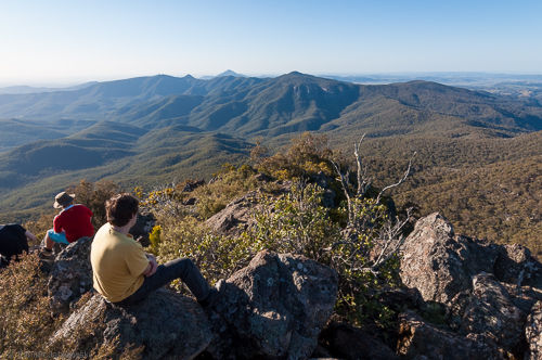
Siding Spring Mountain (1165 m)
Mt. Warning (1156 m)
Mt. Solitary (950 m)
In the Blue Mountains.
The Ruined Castle
In the Blue Mountains.
Own measurement: S33° 45.798 E150° 17.649, 813 m.
Climbed: 2017-04
NSW | ACT | TAS | VIC | NT | Changes
Australian Capital Territory
Mt. Ainslie
Own measurement: S35° 16.182 E149° 09.529, 858 m.
Climbed: 3?, 2014-05
NSW | ACT | TAS | VIC | NT | Changes
Tasmania
Mt. Ossa (1617 m)
Highest in Tasmania. Central Plateau, Cradle Mountain – Lake St Clair national park.
Own measurement: S41° 52.264 E146° 02.004, 1615 m.
Climbed: 2013-12
Legges Tor (1572 m)
Ben Lomond range.
Giblin Peak (1569 m)
Ben Lomond range, close to Legges Tor.
Mt. Pelion West (1560 m)
Central Plateau, Cradle Mountain – Lake St Clair national park.
Mt. Pelion East (1433 m)
Central Plateau, Cradle Mountain – Lake St Clair national park.
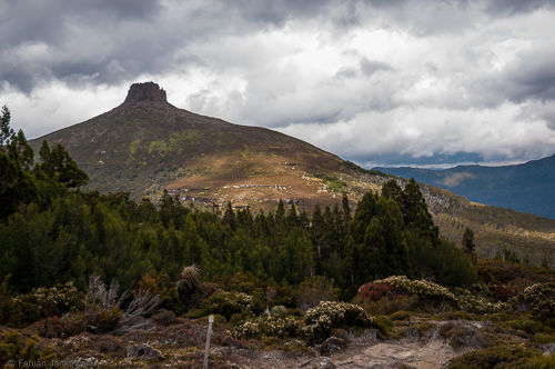
Barn Bluff (1559 m)
Central Plateau, Cradle Mountain – Lake St Clair national park.
Own measurement: S41° 43.424 E145° 55.435, 1558 m.
Climbed: 2013-12
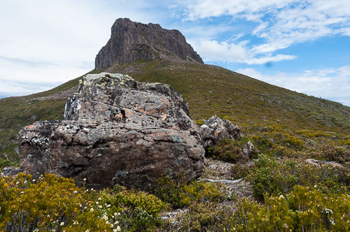
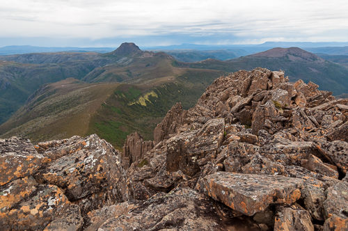
Cradle Mountain (1545 m)
Central Plateau, Cradle Mountain – Lake St Clair national park.
Own measurement: S41° 41.076 E145° 57.073, 1546 m.
Climbed: 2013-12
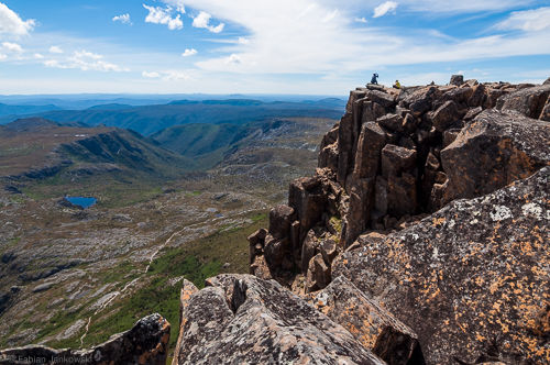
Mt. Geryon
Central Plateau, Cradle Mountain – Lake St Clair national park. Mt. Geryon has three distinctive peaks: Mt. Geryon North, South and the middle peak which is called The Foresight.
- North: 1516 m.
- South: 1509 m.
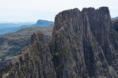
Mt. Massif (1514 m)
Central Plateau, Cradle Mountain – Lake St Clair national park.
Own measurement: S41° 54.426 E146° 03.728, 1470 m (this is in the Mt. Massif summit bowl, about 150 m from the designated summit).
Climbed: 2017-12
King Davids Peak (1509 m)
Walls of Jerusalem national park.
Own measurement: S41° 49.188 E146° 17.385, 1458 m (this was not measured on the summit, but about 400 m South of it).
Climbed: 2015-01 (had to return about 400 m before the summit)
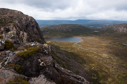
Mt. Gould (1491 m)
Central Plateau, Cradle Mountain – Lake St Clair national park.
Castle Crag/Falling Mountain (1482 m)
Central Plateau, Cradle Mountain – Lake St Clair national park.
Own measurement: S41° 54.703 E146° 05.760, 1466 m (this is only a few metres off the designated summit of Falling Mountain).
Climbed: 2017-12
The Acropolis (1481 m)
Central Plateau, Cradle Mountain – Lake St Clair national park.
Own measurement: S41° 56.114 E146° 03.691, 1485 m.
Climbed: 2015-12, 2013-12
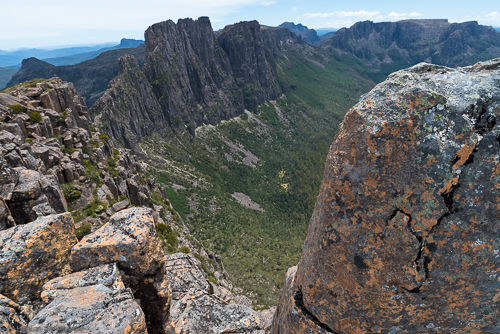
Mt. Hyperion (1480 m)
Central Plateau, Cradle Mountain – Lake St Clair national park.
Mt. Jerusalem (1459 m)
Walls of Jerusalem national park.
Own measurement: S41° 49.226 E146° 19.456, 1463 m.
Climbed: 2015-01

Solomons Throne (1446 m)
Walls of Jerusalem national park.
Own measurement: S41° 49.468 E146° 17.833, 1472 m.
Climbed: 2015-01
Frenchmans Cap (1446 m)
Franklin-Gordon Wild Rivers national park.
Own measurement: S42° 16.184 E145° 49.828, 1447 m.
Climbed: 2016-01
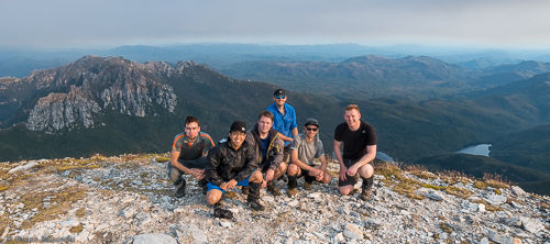
Walled Mountain (1431 m)
Central Plateau, Cradle Mountain – Lake St Clair national park.
Climbed: 2016-12 (only managed to get halfway up due to time constraints)
Mt. Anne (1425 m)
Southwest national park.
Cathedral Mountain (1387 m)
Central Plateau, Cradle Mountain – Lake St Clair national park.
Mt. Wellington (1271 m)
On the outskirts of Hobart.
Own measurement: S42° 53.759 E147° 14.238, 1274 m.
Climbed: 2017-01
Federation Peak (1224 m)
Easter Arthur range, Southwest national park. Most certainly the hardest peak to bag in Tasmania, mainly due to the changable weather.
Mt. Hayes (1119 m)
Western Arthur range, Southwest national park.
Own measurement: S43° 07.943 E146° 14.833, 1121 m.
Climbed: 2017-01
NSW | ACT | TAS | VIC | NT | Changes
Victoria
Mt. Bogong (1986 m)
Highest in Victoria.
Own measurement: S36° 43.940 E147° 18.351, 1991 m.
Climbed: 2014-04
Mt. Feathertop (1922 m)
Own measurement: S36° 53.650 E147° 08.287, 1927 m.
Climbed: 2017-09 (unsuccessful, needed to return due to soft snow), 2015-09 (winter), 2014-11 (summer)
Mt. Hotham (1862 m)
Mt. Buller (1805 m)
Own measurement: S37° 08.643 E146° 25.679, 1787 m (the coordinates are about 150 m off from the designated summit).
Climbed: 2016-07 (in winter using snowshoes)
Mt. Howitt (1742 m)
Own measurement: S37° 10.455 E146° 38.863, 1747 m.
Climbed: 2017-01
Mt. Stirling (1742 m)
Mt. Buffalo
-
The Horn (1723 m)
Own measurement: S36° 46.581 E146° 46.049, 1726 m.
Climbed: 2014-11
-
The Hump (1695 m)
Own measurement: S36° 45.502 E146° 47.252, 1703 m.
Climbed: 2014-11
Mt. Speculation (1658 m)
Own measurement: S37° 07.500 E146° 38.641, 1670 m.
Climbed: 2017-01
Mt. Buggery (1598 m)
The official elevation is not well defined (1583 - 1598 m).
Own measurement: S37° 08.555 E146° 38.444, 1616 m.
Climbed: 2017-01
Mt. Baw Baw (1567 m)
The Viking
-
Main peak (1519 m)
Own measurement: S37° 07.135 E146° 43.105, 1518 m.
Climbed: 2017-01
-
South Viking (1487 m)
Own measurement: S37° 07.534 E146° 43.325, 1509 m.
Climbed: 2017-01
Mt. Despair (1461 m)
The elevation of the summit is not well established, with values between 1383 - 1461 m.
Own measurement: S37° 06.798 E146° 40.447, 1469 m.
Climbed: 2017-01
Lake Mountain (1433 m)
Own measurement: S37° 30.242 E145° 52.846, 1440 m.
Climbed: 2014-08
Mt. William (1167 m)
Southern Grampians.
Own measurement: S37° 17.566 E142° 36.067, 1167 m.
Climbed: 3?, 2015-10, 2015-03
Camels Hump (1011 m)
In the Macedon Ranges.
Own measurement: S37° 22.222 E144° 35.847, 1007 m.
Climbed: 2, 2015-12
Mt. Rosea (1009 m)
Northern Grampians.
Own measurement: S37° 11.817 E142° 30.395, 1007 m.
Climbed: 2014-10
Mt. Macedon (1001 m)
Own measurement: S37° 23.378 E144° 34.617, 997 m (next to Memorial Cross).
Climbed: 3, 2015-12, 2014-08
Mt. Thackeray (979 m)
Southern Grampians.
The Fortress (875 m)
Southern Grampians.
Mt. Abrupt (827 m)
Southern Grampians.
Own measurement: S37° 35.867 E142° 21.217, 833 m.
Climbed: 2015-03
Mt. Towrong (813 m)
In the Macedon Ranges.
Own measurement: S37° 23.836 E144° 36.079, 814 m.
Climbed: 2015-12
Mt. Difficult (808 m)
Northern Grampians.
Sundial Peak (802 m)
Northern Grampians.
The Pinnacle (715 m)
Northern Grampians.
Own measurement: S37° 09.610 E142° 30.942, 652 m.
Climbed: 2?, 2014-10
Mt. Dandenong (633 m)
Own measurement: S37° 49.617 E145° 21.182, 633 m (position is slightly off from designated summit).
Climbed: 6+
Mt. Oberon (547 m)
Highest point at Wilsons Prom.
Own measurement: S39° 02.414 E146° 20.690, 567 m.
Climbed: 2016-04
Mt. Stapylton (518 m)
Northern Grampians. The final ascent includes an easy scramble to the summit.
Own measurement: S36° 53.910 E142° 23.238, 527 m.
Climbed: 2016-10
Hollow Mountain (388 m)
Northern Grampians.
Kersop Peak (204 m)
At Wilsons Prom.
Own measurement: S39° 03.174 E146° 28.034, 221 m.
Climbed: 2016-02
NSW | ACT | TAS | VIC | NT | Changes
Northern Territory
Kata Tjuta (1066 m)
Uluru/Ayers Rock (863 m)
Own measurement: S25° 20.692 E131° 01.949, 859 m.
Climbed: 2015-10
NSW | ACT | TAS | VIC | NT | Changes
Changes
- 2019-01-14: Improved the navigation.
- 2018-10-15: Changed the list of climbing dates to reverse chronological order and tweaked the text. Improved the formatting of headings.
- 2018-08-29: Improved the title and opening text.
- 2018-06-07: Switched to a fixed URL for this document. Improved the formatting of ridges and sub-peak listings.
- 2018-05-22: Added official elevations of peaks from the literature and sorted the listings. Added dates of measurements and locations of the peaks in ranges and national parks. Added some more measurements, peaks and climbing dates. Corrected some elevations. Replaced the number of climbs by their approximate dates.
- 2017-11-23: Spelling and grammar fixes.
- 2017-01-13: Added Mt. Wellington and Mt. Hayes.
- 2016-10-23: Corrected elevation of Pelion East. Added further photos.
- 2016-10-16: Added first photos of peaks. Tweaked the summary.
- 2016-10-04: Added measurement of Mt. Stapylton and further descriptions of climbs.
- 2016-09-26: Added further measurements, descriptions and improved the navigation. Marked the peaks that I climbed. Released the blog post.
- 2016-08-13: Created this document.